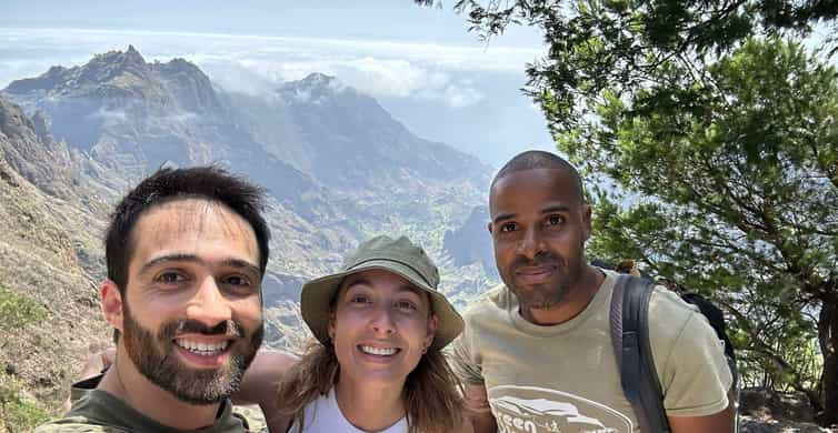
Santo Antão, Cape Verde: what the island is like
Santo Antão is the westernmost of the northern islands and, at about 785 km², the second-largest in Cape Verde, rising to 1,979 m at Topo da Coroa. Its nickname, the island of mountains, is accurate. The trade winds drop their moisture on the north-east, so the valleys of Paul, Ribeira Grande and Ribeira da Torre are green with sugar cane, bananas, yams and coffee, while the south and west around Porto Novo are dry, brown and almost lunar.
Around 37,000 people live here, many in small farming villages built on ridges and terraces. There are no resorts and few sandy beaches: the coast is rocky and the sea usually rough. Santo Antão suits walkers, photographers and anyone happy with simple guesthouses, good local food and early nights. If you want a pool and a beach, stay on Sal or Boa Vista and come here for a few days.
Hiking on Santo Antão: Paul and the Cova crater
The best-known walk starts at the rim of the Cova, an extinct volcanic crater whose flat floor is farmed, and descends into the Ribeira do Paul. The route is about 10 km and takes around four hours downhill, on a cobbled path that zigzags past waterfalls, banana groves and villages such as Cabo da Ribeira and Passagem. The crater, the upper Paul valley, Ribeira da Torre and Pico da Cruz together form the Cova, Paul and Ribeira da Torre Natural Park, on Cape Verde's tentative list for UNESCO World Heritage since 2016.
The descent is steep and hard on the knees, and the crater rim is often in cloud, so start early on a clear day. Most walkers take an aluguer or taxi up to the start and are collected at the bottom in Vila das Pombas. Ribeira da Torre, with the village of Xoxo, is a quieter valley for a half-day walk. For other routes and general advice, see hiking in Cape Verde.
Ponta do Sol and the coast path
Ponta do Sol, at the northern tip, is a small, colourful town around a fishing harbour, with a few guesthouses and restaurants. It is the start of the island's most famous coastal walk: a path cut into the cliffs that climbs to the village of Fontainhas, perched on a narrow ridge above a valley of terraces, and continues past Corvo and Formiguinhas to Cruzinha. The full route takes about five to six hours; many people walk the first stretch to Fontainhas and back.
The path has steep drops in places and little shade. Carry plenty of water, wear proper shoes and avoid it in heavy rain.
Ribeira Grande and Paul
Ribeira Grande, also called Povoação, is the main town of the north, squeezed where two valleys meet the sea, with banks, shops and the main transport hub of the north. It is a practical stop, a few kilometres from Ponta do Sol, rather than a place to linger.
Paul, on the east coast, is the greenest municipality; its seaside town is Vila das Pombas, at the mouth of the Paul valley. The valley is the home of grogue, the sugar-cane spirit, still made in small distilleries with traditional mills. Ask for a tasting, but remember the paths are steep on the way back.
Getting there: the ferry from Mindelo to Porto Novo
Santo Antão has no airport in service: the old airstrip near Ponta do Sol closed at the end of the 1990s. The way in is the ferry from Mindelo on São Vicente to Porto Novo, run by CV Interilhas several times a day, with a crossing of about 40 minutes to an hour. The channel is often rough, so take seasickness tablets if you are prone to it. Buy tickets online or at the port and arrive early. To reach Mindelo, fly from Sal or Praia, or from Lisbon; see island hopping.
From Porto Novo, aluguers meet the boats and run to Ribeira Grande, Paul and Ponta do Sol; pay in cash. There are two routes north: the old mountain road over the Corda, with views over the valleys on clear days, and the faster coastal road via Janela. The coastal road runs under steep slopes, and in January 2025 a falling rock killed two people in a car on it, so heed any closures, especially after rain. A private taxi costs much more than a shared seat but lets you stop for photos.
Where to stay and how many days
Ponta do Sol and Ribeira Grande are the most convenient bases for the north and its walks, with the widest choice of guesthouses. The Paul valley has rural guesthouses where you wake up among the terraces, ideal for walkers. Porto Novo is handy for an early ferry but far from the best trails. For something remote, Tarrafal de Monte Trigo in the south-west is sheltered from the wind but slow to reach. See where to stay in Cape Verde.
Plan three to five nights: enough for the Cova to Paul descent, the coast path from Ponta do Sol and a rest day. A day trip from Mindelo is possible on an organised tour, but it is a long day mostly spent in a vehicle. Cash is important, as card payments are limited outside the towns; read our currency and prices guide.
The dry months from about November to June are the best for hiking, although winter haze can hide the views; the August to October rains turn the valleys greenest but can cause landslides. Check the weather and the best time to visit before booking. In late June, Porto Novo celebrates São João with drums and processions.